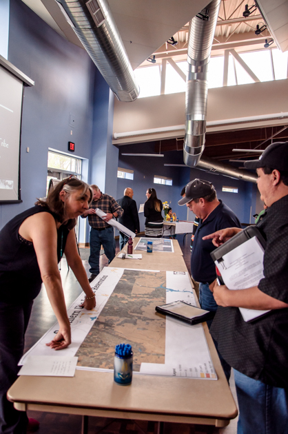
On Tuesday, May 12 Tribal Planning held two kick-off meetings, one with multiple Southern Ute Departments, Growth Fund, town officials, CDOT; and one special meeting for the tribal membership. The meetings were held to discuss the Tribal Transportation Safety Plan and the Long Range Transportation Plan Update. If you were unable to attend one the meetings here is what you need to know:
- The tribe has hired WHPacific – a 100 percent Native American owned engineering, architecture, planning, and surveying firm – to complete a Long Range Transportation Plan Update and Tribal Traffic Safety Plan for the tribe.
- WHPacific will be on the reservation taking photos and traffic counts on various roadways
around the reservation from late-May through mid-June.
- The plans play an integral role in the tribe receiving federal funding for roadway improvements.
Tribal Transportation Safety Plan (TTSP)
- The tribe has received funds from the Federal Highways Administration and is working on developing a Tribal Transportation Safety Plan.
- The Tribal Traffic Safety Plan will be used to document safety concerns on Tribal, BIA, County and State-owned roads serving tribal lands.
- Tribal Planning has mailed out transportation safety questionnaires and comment forms to all Southern Ute tribal members. The questionnaire addresses safety issues such as: road conditions, driver behavior, boating, pedestrians and other hazards.
- Tribal Planning is looking for insight from tribal members on hazardous roads that are cause for concern, for both vehicle and pedestrian traffic.
- Areas of concern already pointed out by the tribal membership include: County Road 213, wildlife issues, La Boca bridge, Bear Dance Bridge, future housing infrastructure, oil and gas road and bike and pedestrian trails.
- The plan is a tool to identify and address risk factors that can lead to injuries and death.
Long Range Transportation Plan Update (LRTP)
- The Long Range Transportation Plan Update is used to clearly demonstrate the tribe’s transportation needs for the next 20 years.
- Strategies developed in the plan will address future land use, economic development, traffic demand, public safety, health and social needs.
- LRTP looks at the short, mid, and long term needs. Such as safety hazards, signage, future developments and pedestrian developments.
- The plan ensures the tribe’s development priorities are supported by transportation infrastructure.
- The draft of the plan is scheduled to be completed by November 2015.
- The Long Range Transportation Plan Update is eligible for Bureau of Indian Affairs funding.
- Roads funded by the BIA cannot restrict public access.
- The Long Range Transportation Plan was first completed in 2006 and the current plan being worked on is an update. New data will be compared to 2006 data to compare trends.
Any more questions concerning the plans can be addressed to Tribal Planning at 970-563-4749.