


This Winter has been below average, so the Water Resources Division (WRD) decided to update the community on current snowpack, drought conditions and weather outlooks. The last Drought Update was published, Oct. 16, 2025.
Snowpack
Currently, the San Juan Basin in Southwest Colorado is at 46.5% of the 1991-2020 Median Snow Water Equivalent (SWE). Our basin had a delayed start to Winter as we didn’t receive any significant snowpack until late November 2025. All winter our basin has been below normal, but with the lack of precipitation since the holidays, we’ve dropped well below normal. Figure 2 shows this winter’s SWE trend (black line) compared to the 1991-2020 median (green line) and the trends for the last three winters (2025 blue line, 2024 orange line, and 2023 purple line). Our basin needs a lot of snow to at least reach normal. Figure 2 also shows that there are 56 days until the median snowpack peak. We have approximately two months until peak snowpack, so hopefully February and March will have greater precipitation to at least reach normal. The Weather Outlooks section below will describe what the current weather models are showing for the next couple of months.
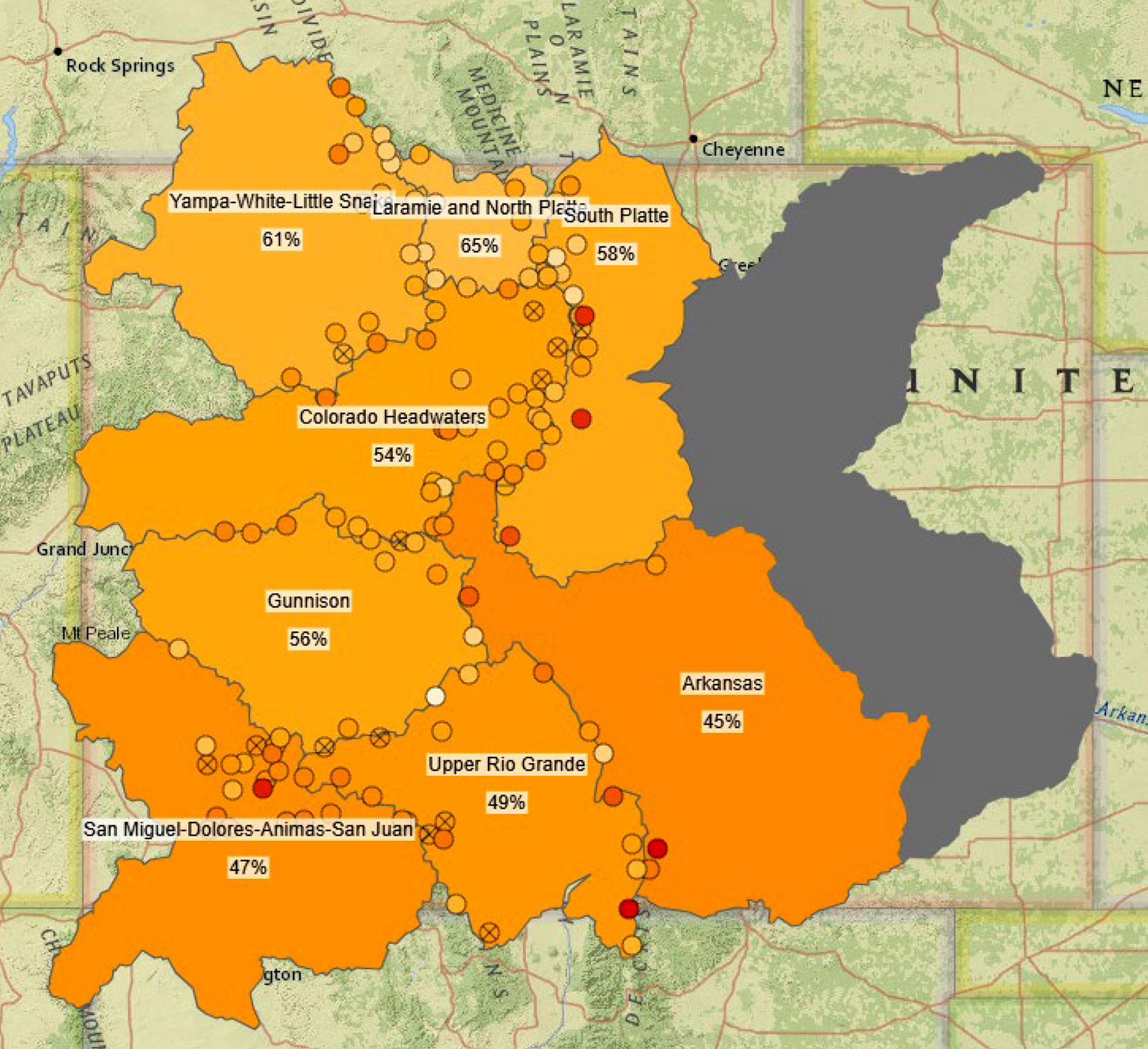
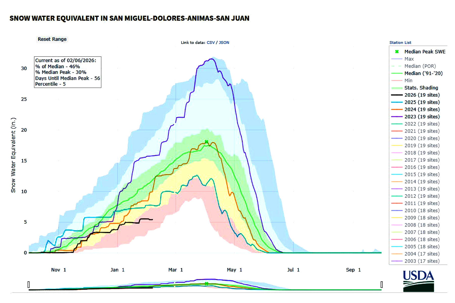
Figure 2. Temporal SWE trends for the San Miguel-Dolores-Animas-San Juan river basin. This winter’s SWE trend (black line) compared to the 1991-2020 median (green line) and the trends for the last three winters (2025 blue line, 2024 orange line, and 2023 purple line).
Water professionals use the term “Water Year” which is Oct. 1 to Sept. 30 to align with the natural hydrologic cycle (Generally including precipitation, accumulation, runoff, infiltration and evapotranspiration). In Water Year 2026 (10/1/2025 to present), the rain gage at the Water Resources Division (WRD) office has received 6.13 inches of liquid precipitation. Our region received a few snowstorms in November and December of 2025. However, many of you probably remember the big rainstorms we received in mid-October that resulted in significant flooding. Since Water Year 2026 started 10/1/2025, that rainstorm was captured in the current water year which is why the WRD office and surrounding rain gages show such high liquid precipitation records. For comparison, since Jan. 1, 2026, the WRD office rain gage has received 0.62 inches of liquid precipitation.
The October 2025 rainstorms increased reservoir levels a lot. Local reservoirs are currently doing well, which will help the 2026 irrigation season a lot if snowpack doesn’t significantly improve. Vallecito is currently 84% full, and Lemon is currently 70% full, which are great water levels for this time of year.
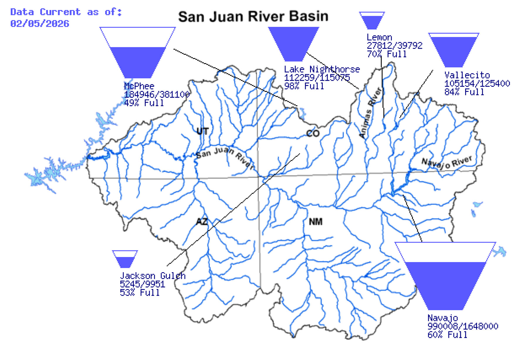
Figure 3. Current fill levels for local reservoirs.
Drought
Most of western Colorado is in some level of drought including the southwestern part of the state which has drought conditions ranging from Abnormally Dry to Moderate Drought. The Southern Ute Reservation currently has Abnormally Dry conditions with a very small amount of Moderate Drought in the NE and SW corners. The U.S. Drought Outlook shows southwest Colorado drought persisting and further development likely from now until April.
The ENSO Neutral conditions do seem to be increasing each month with El Niño conditions being most probable over the summer months, so hopefully conditions and weather patterns will change soon, and we will receive some much-needed precipitation throughout the year. In past ENSO probability forecasts, the blue bars (La Niña) have been the highest over the last few years. In the current forecast, the blue bars are the lowest so maybe we will have a change in weather patterns this year, but only time will tell.
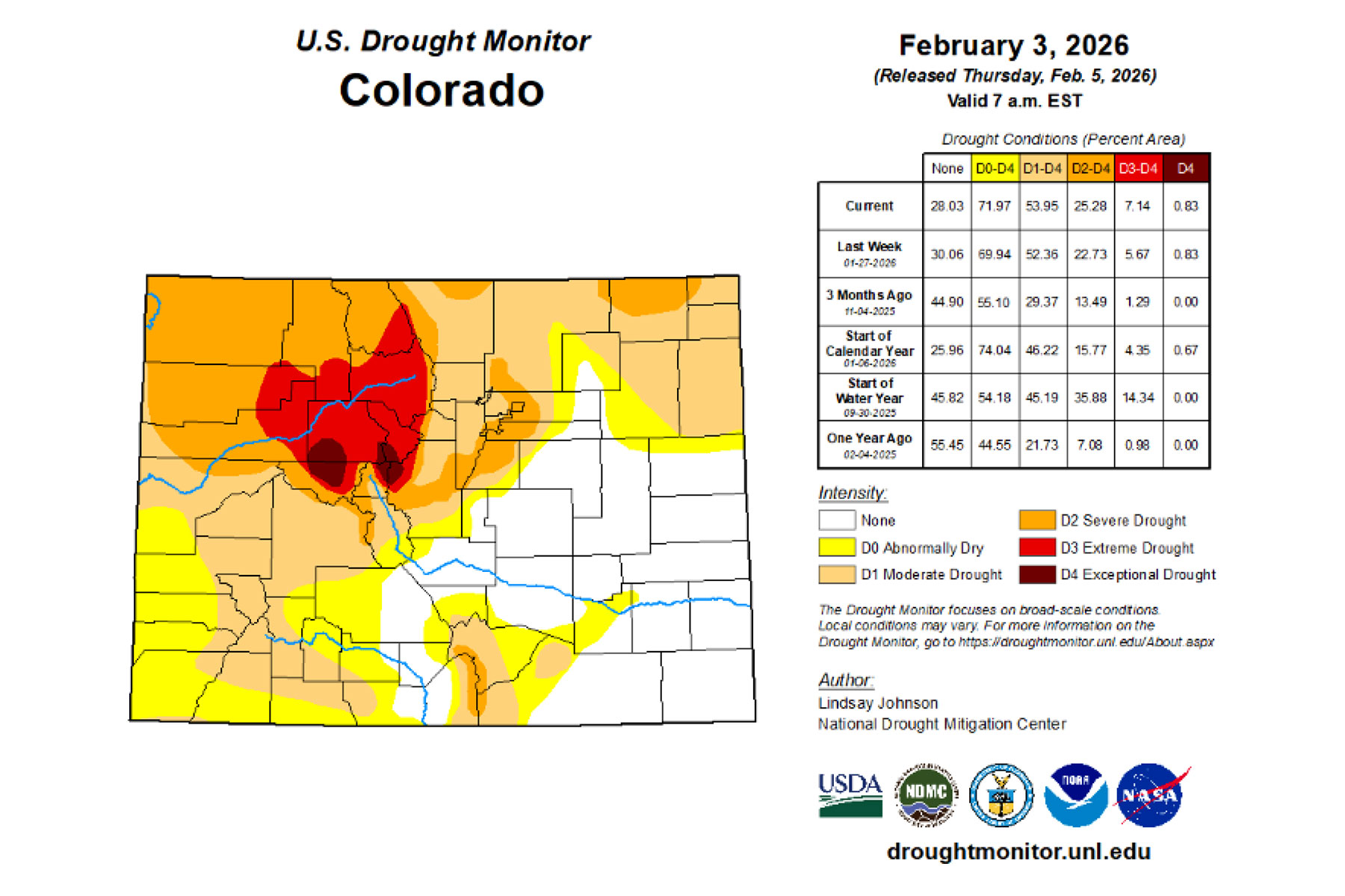
Figure 4. State of Colorado Drought Monitor.
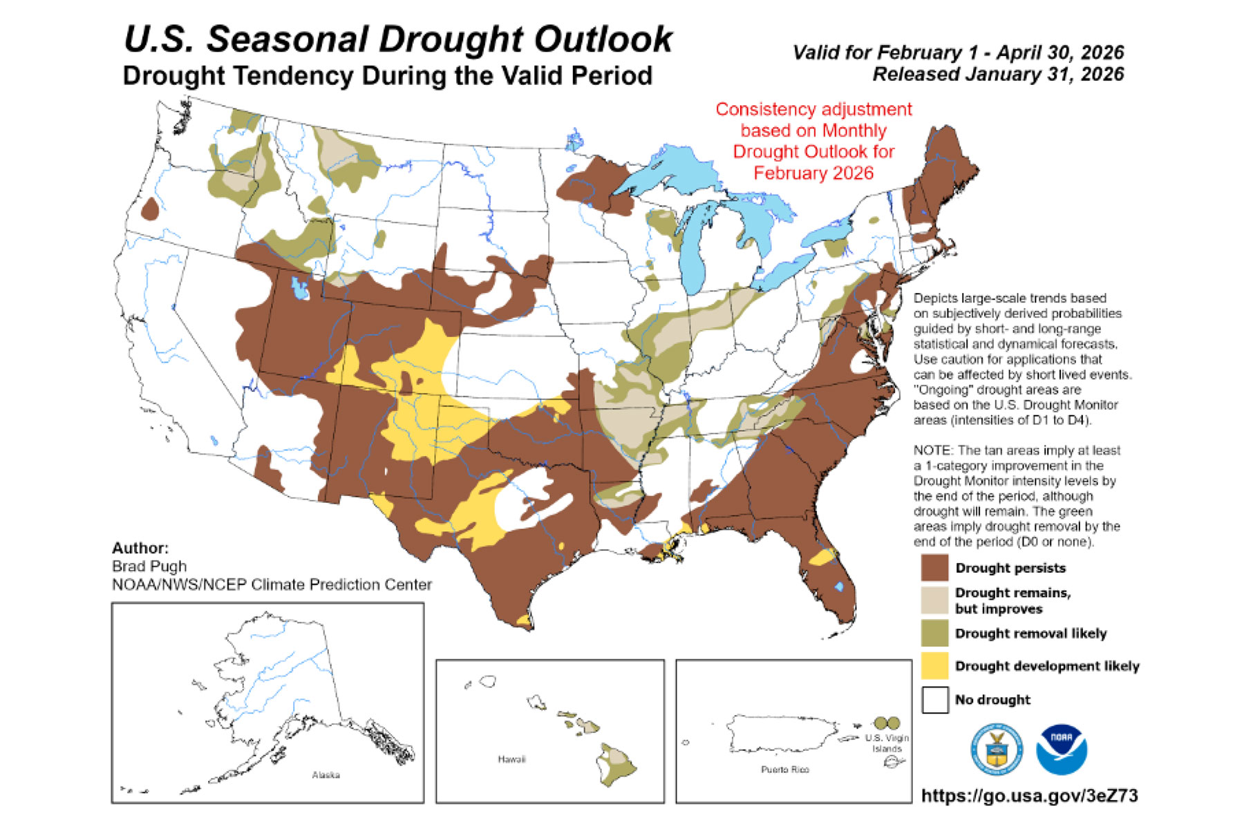
Figure 6. US seasonal drought outlook through 4/30/2026.

Figure 7. Mid-January 2026 ENSO Forecasts.
Weather Outlook
The outlooks for February to April 2026 show southwest Colorado experiencing below average precipitation with above average temperatures. If the models are accurate, the remainder of Winter could stay below average, but keep in mind things can change. NOAA’s previous seven-day forecast predicted the recent precipitation in our region, which will certainly boost snowpack in the mountains. Snow in the mid and low elevations would be great, but right now any precipitation below 10,000 feet is welcome.
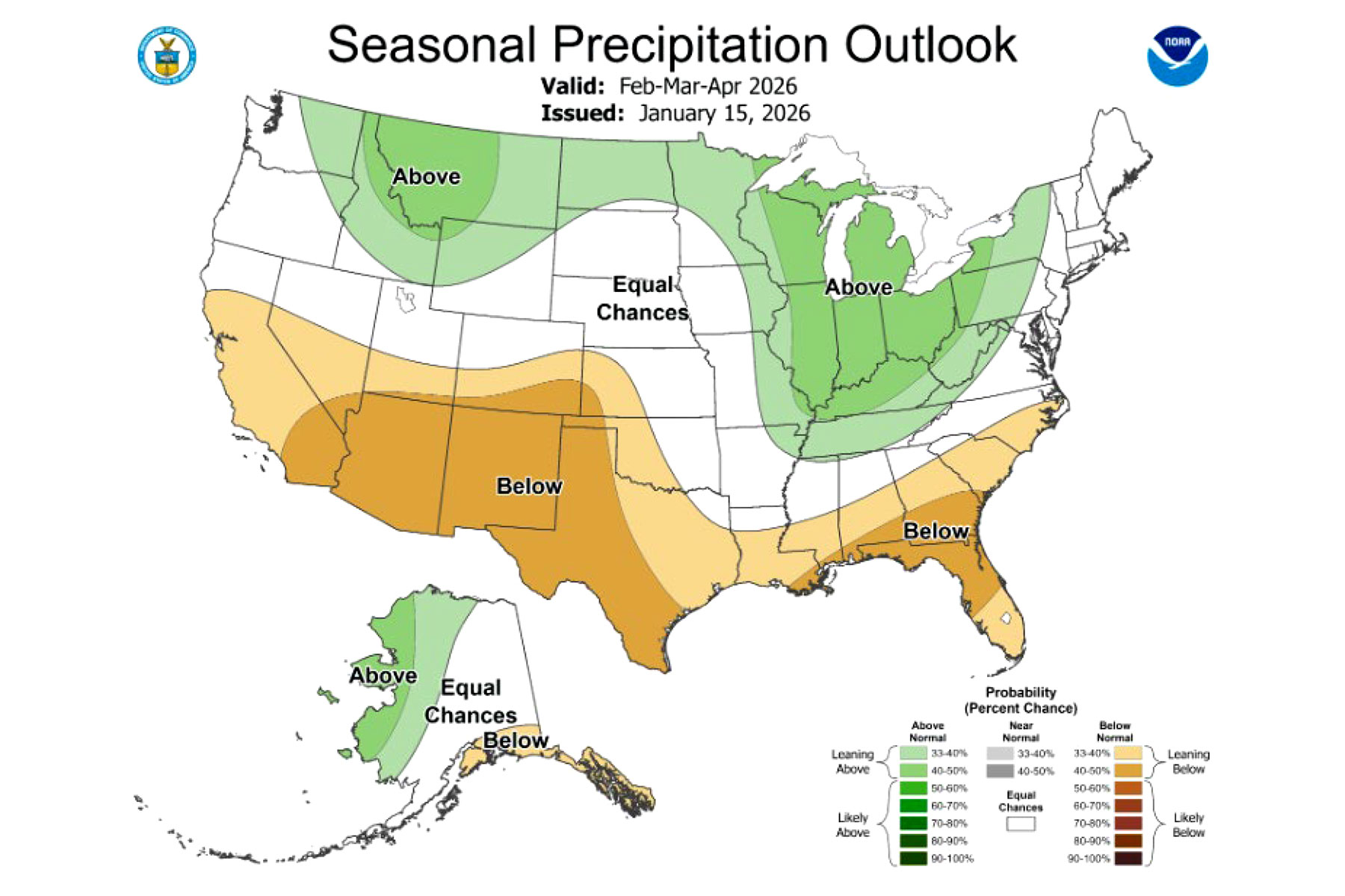
Figure 8. US precipitation outlook through April 2026.
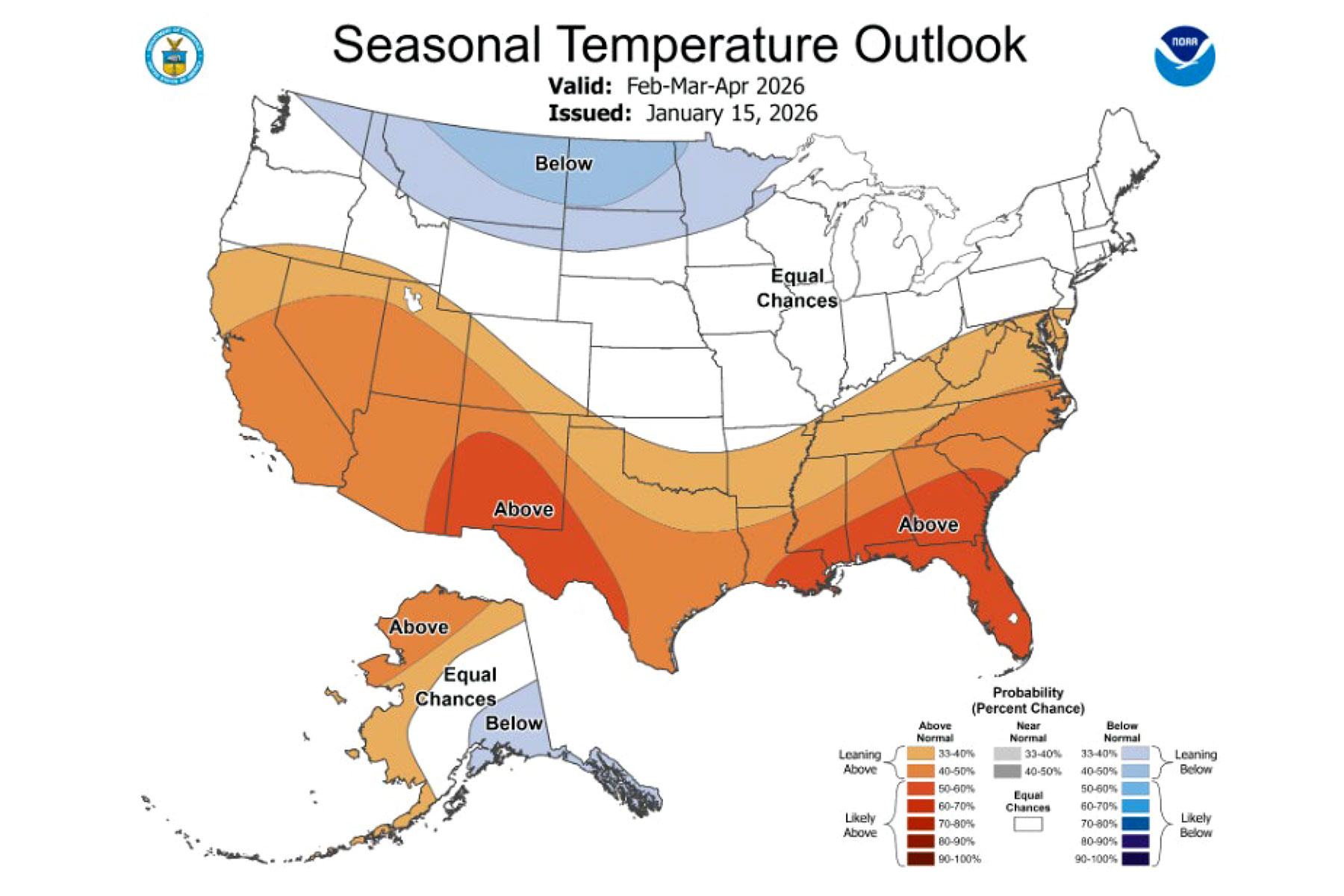
Figure 9. US temperature outlook through April 2026.
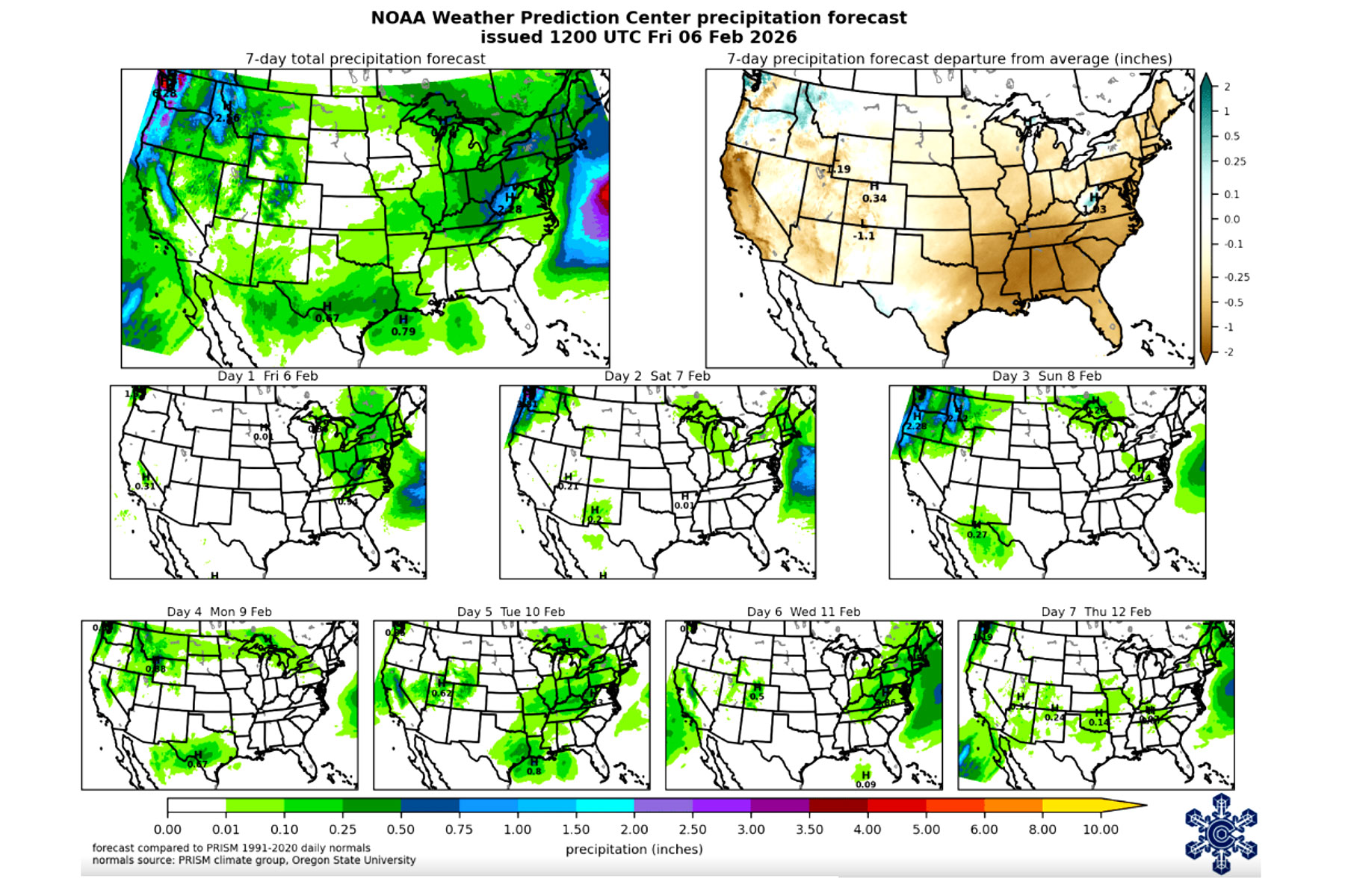
Figure 10. NOAA 7-day Weather Prediction for 2/6-2/12.
The Water Resources Division will keep track of drought conditions and forecasts and update the Task Force when major changes occur. If you’d like more information, feel free to reach out to George Gavrielides, Water Resources Specialist, at 970-563-2932.