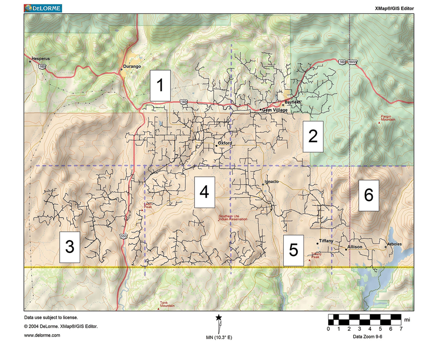
 This information is critically important for local agencies, BP field personnel and BP Dispatch’s awareness of our aerial leak detection survey and possible concerned phone calls from the public. Attached is a flight area reference map if needed.
Beginning Monday May 11, about mid – morning, we will begin surveying BP’s pipelines via a helicopter equipped with a leak detection system. In addition to identifying any possible leaks, the crew will also be searching for other pipeline integrity issues within our pipeline Rights of Way including pipeline wash-outs, ground disturbance, and other unusual activity near our lines. This task will continue for about 10-14 days.
Each day’s documented fight plan will be subject to change due to weather. Therefore, BP SJN Dispatch, LaPlata County Emergency and Southern Ute Tribal Police will be notified daily of our flight plan for their use in receiving calls from landowners or others. In addition, local newspapers will begin printing a public notice of this activity beginning the first weekend in May. The survey will also cover some of Red Cedar pipelines which will be scheduled to take place after all BP pipelines are flown. Red Cedar will be handling notifications when the surveys include only their lines. Ritchie Hart will notify BP Dispatch of this when BP’s aerial survey work is complete.
The company doing this task for us is LASEN Airborne LIDAR Pipeline Inspection Service.
Chopper type: Bell Jet Ranger
The chopper color: Blue/White
The Tail number: 284CA
Flying height: about 200 feet (100 ft. to 350 ft. possible)
Flight times: 8 hour days – within 7 am to 6 pm.
Ritchie Hart: 970-749-7421 will be the point of contact from LaSen Airbourne.
The crew is familiar with wildlife and livestock in the area and their habits. They have promised to stay away from these issues as needed. We will be meeting with the crew before flights begin on May 11 to stress our concerns about this subject as well as ensuring they will not hover in place when close to residential areas or fly too low when livestock or wildlife is spotted.
With this information you now have a description of our aerial survey plan. Please document all received phone calls and provide any information requiring our follow-up to one of the following: Ritchie Hart at 970-749-7421 or Hal Koenig, BP Security at 970-769-1523.